Backpacking in Plumas County
page 1 page 2 page 3 page 4 page 5
(scroll down for pics, or click across to other pages)
Day 1
Memorial Day long weekend, I ran away from my girlfriend and eloped with her friends for the weekend, much to the humour of all involved. Lisa was working, but her friends had organised a backpacking trip, which sounded like much more fun.
After rushing to get some work done, trying to get to the dentist to have a filling adjusted, locking my keys in the car, I finally got on the road. I was driving up with James and Junko. We left cisco at about 3ish, and had some fairly heavy traffic until we got past sacto. Dinner in Truckee, then onwards to graegle. This is where it got silly. James had "directions" and navigated for me, but it turned out that they only took us to the center of the zipcode, and then after backtracking to where I thought was the right place, we ended up flying past the actual turnoff to the right camp. Oops. We went on quite a tour of the Gold Lake Highway before finally turning up at the right campsite about an hour behind the others.
Set up camp in the drizzle, and had a beer or two by the fire nicely left for us by Doug and Mary-Anne. Bed, and then up for a new day. Which was beautifully clear, thankfully.
Got the REI map off Ben, and fired up the new GPS (Garmin geko 301) to enter in some waypoints, so I could give it a try out. Quite the geek I guess. Chatted to the camp host a bit about the weather, and then it was time to head off. Very leisurely heading off mind you, it was just going on 11am. No matter, we only had 6 miles or so to do.
Cruised out the track, which was mostly gently downhill, and often running with water, crossing a couple of creeks, and eventually deciding to go and check out Lily Lake for our first stop. We should have known from the overhead cables that started appearing as we crossed the creek that Lily Lake wasn't going to be all that remote. We had just put our packs down when a rumble from the distance showed us the road just on the other side of the lake. Oh well :)
So we walked, taking our leisurely time, crossing the creek again (and the road again) by Grey Eagle Lodge, then up the hill towards Smith lake. Smith Lake was very pleasant, and would have made a nice campsite, but we hadn't exactly gone very far yet. So we had lunch, then continued on. From Smith Lake, it was up the hill under an enormous snag, and then past a quiet unmarked lake surrounded by sugar pines. Then down down down the other side, thinking about the slog back up on monday, to another stop by Jamison Falls. Quite pretty falls, unfortunately a fair bit of brush in the way. A short meader up the track took us to Grass Lake, and our campsite for the next two days.
Day 2
blah blah blah. We walked up the hill attempting to get to the top of Mt Washington. We threw snowballs at each other, we lost the track now and again, we slept on logs, we plodded around on top of the snowbanks amongst the pine tress on the summit ridge. Brian and I even tried a bit of manzinita bashing and scrambling to see if we could get to the top.
But we failed. So we returned down the hill, glissading, throwing snowballs, and having a bit of a wade around in Wade's Lake. (which would make a superb campsite) Eventually, after a few more people missed turnoffs, and wandered around by themselves for a while, we all ended up back at camp together, for our big shared dinner of indian food in hot pouches. Lots of couscous, and then some fire and chatting. It was very pleasant to be in National Forrest, and just having a fire, we hadn't need to get any permits, meet any quotas, no bear boxes, and we still had rugged mountains, lakes, and some backpacking. The odd rumble of trucks in the distance of course, and only 5500feet or so, but a VERY nice change from trying to get onto the track you want in the Sierras.
Some cards, some chatting, some abominable drinks concoted of polish straight alcohol and gatorade, (yuck) and it was time to call it a night. But not before I decided to go and take some night photos. I walked off down to Jamison Falls again, but it sort of sucked, so on the way home, I walked out onto the dam wall of Grass Lake, and got the best shots of the trip. Perfectly still waters, with the snowy ridgeline before me. I'd already got the exposures down pat from the earlier shots at Jamison Falls, so got a couple of excellent shots. The GPS is very useful as a clock. Makes it much easier to get exposures dialed in when you know how long you are actually making them.
Day 3
Pack up, and walk out. Pretty simple really. Oh, except that half the group decided to go "Brian Bashing" which involved walking straight past the sign saying where to turn, and ending up a mile down the hill at a mine site, and having to come all the way back up again. Noticeably less water in the creek crossing by Lily lake, but by and large a fairly eventfree return walk. We all abused the tap and toilets back at the campsite pretty hard, having a wash, then it was off for a big shared dinner on the floor of a nice thai place in Davis, and home again!
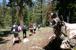
Ben, Olivia, Brian, James, Junko, Nina. Starting the day | 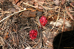
Strange red things that we saw lots of (tell us what they are!) | 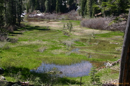
Grassy Lake (not to be confused with Grass Lake) | 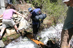
Creek crossing #1 |
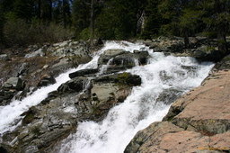
Cascades above the Hawley Falls slot | 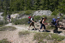
R->L Olivia, Junko, Brian, Ben. | 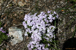
Pretty flowers | 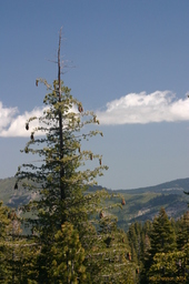
A sugar pine, loaded with cones |
|