16 Jan, 2011
After a particularly Saturday spent indoors doing absolutely nothing on a computer while looking out the window at blue skies, I finally got into gear around sunset and cooked up a plan to go out on Sunday. Thanks to Iveta, or I probably would have just been too lazy the whole weekend.
We were trying to find somewhere that a) had half decent weather, b) was going to be actually possible in mid winter, and c) was preferably somewhere we'd never been before. I found a couple of smallish mountains, and will keep Vörðufell up my sleeve for another time, but it was likely to have its head in the clouds this day. Scanning my maps, I noticed some waterfalls and canyons near the end of a jeep road at the back of Flúðir, and thought it sounded promising.
We headed out before lunch, Iveta and a friend of hers, Milos, and I, through pretty mucky grey drizzle and an uninspiring forecast for the rest of the day, but damnit, we all wanted to get out of town for a while, so weather be damned.
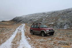
We found the start of the road ok, and I was immediately happy with the choice of destination. This was why I'd recently bought a jeep. To be able to go places that the micra couldn't, and _then_ go for a walk! After a few km, we got to an unexpected fork in the road. I knew I should have _actually_ put some points in the GPS, and never trusted that an old map showing a single track to a clear ending at a water fall would still be correct. I was pretty sure we were close though, so we parked the car, and decided it was time for walking.
So, if you're following along at home, and have more maps, the left fork continues on to Kistufoss and an unlabelled hut of some sort. The right fork, up and over the hill, appears to cross Litli Laxá, and just go up the farm, Kaldbakur. Oh yeah, the Kistufoss we're talking about is on a canyon on Litli Laxá, and the jeep track takes off from the road leading up to the farm Berghylur.
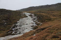
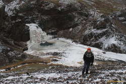
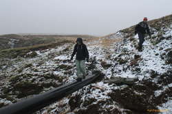
We took the right fork :) Althought not the "correct" way, this meant that we got a lovely stroll up a frozen creek bed, found a fox/mink burrow, with tracks on the ice, and finally arrived up at what I'll call, "Lower Kistufoss." It is a bit hard to tell from the map which of the two waterfalls is the "real" one, so I'll go with upper and lower.
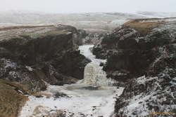
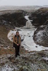
Nice cute waterfall, dropping out of a frozen little gorge into a cute little grotto. Our original plan had been to continue walking up the river as far as the next river junction, where there's another waterfall, labelled "Kerlingarfoss", but it was already 3:30pm, and in mid January, facing a 5-6km each way walk up stream, this really seemed like a poor idea.
But walking up to have a better look at the gorge wasn't. It was a good idea :) The gorge itself reminded me of a bobsled/luge track, just a winding snake of mostly pretty smooth ice, with walls. Upper Kistufoss was a nice spot, but it's mostly hidden behind a raised flake of lava.
Given the way we'd walked, we were pretty sure we'd find the road again if we continued around, and yes, we hit the road very quickly, and were only about 2km back down the road to the car!
Of course, not having enough time to go for a long explore upstream didn't mean we couldn't stop at a hot pot on the way home :) And the pool near Flúðir was right in the neighbourhood. However, surprisingly, this pool is not particularly nice in winter. The water level was about 20-25cm lower than in summer, so it was no longer flowing through. The lower pool, attached to the changing room was just an inch of ice, and the upper pool was stagnant and brown. Oh well. A great day out!
This was also the first time I got to try out the GPS on my new phone (a Vodafone 845) side by side with my existing Garmin Geko 201. They both seem pretty much as accurate as each other, though the phone absolutely eats battery!