12-15 August, 2010
Askja was an interesting place. We'd come in somewhat late, after taking about 9 hours to drive 115km, and were relaxing with some of Bjöggi's delicious chicken soup, and a refreshing beverage or two. It had drizzled on and off for the evening, and then just before bed, Bjöggi got me to turn around and look at the fog coming in.
And I mean _reallly_ coming in! It just swept up the valley and eveloped the entire campground.
We went to bed, but about 3 minutes later I'd forgotten something and got out of the tent, just in time to watch the fog retreating back down valley, just as fast as it had come. Surreal to watch.
Day dawned, and as forecast, it was warm and sunny. Our plan for the day was to head down to Hveragil, a side canyon near Kverkfjöll, which has hot water raining into it. Apparently it's not really worth going to in summer, as the glacial melt cools it down too much, but without crampons or ice gear, we didn't feel like just driving to the cabin at Kverkfjöll.
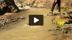
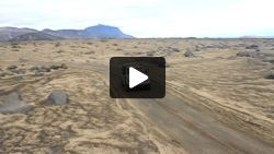
But first, a trip up Drekagil, the canyon above the campground. The fields around around Askja are covered in pumice, and I mean _really_ covered in pumice. For kilometers in all directions, it's just creamy white gravel, with dark grey lava lumps sticking through. _All_ the creamy white stuff is pumice. I'd never seen so much before. At Glass Mountain in northern California, I'd seen some really enormous chunks of pumice, but it was basically just one outcropping. The pumice fields around Askja are ENORMOUS. And the creek running down drekagil is littered with pumice, floating downstream. At the head of the canyon is a quite nice little waterfall, with pumice mixed in with the water.
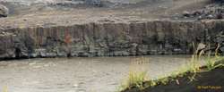
Quite a nice distraction, but now it was time for driving! We were about to get onto new roads again! The F910 down to Upptyppingur, then F902 south towards the glacier. We stopped at the bridge over Jökulsá á Fjöllum for a look around, the water just thumps through the narrows here, shaking the bridge. It sure is a big river.
And, because we had the highland handbook, not just a map, we also took a short walk here. To the Ættartré. This iz a bizarre art installation from the mid-late 70s, by some Dutch/German artists, detailing a family tree from the Völsunga Saga. It's really rather odd, especially to find so far away from anywhere.
We head south, on remarkably good roads, and eventually turn off from Kverkfjöll, towards Hvannalindir. We turn off our side road to Hveragil, which feels tough, heading off into proper jeep only territory, but it's not really early in the day. With no camping allowed in this area other than at Kverkfjöll, we don't really relish the idea of another 40km of slow jeeping, then a return, then a drive north to get to a campground, so we have a late lunch on the top of a hill admiring the sights south over Kreppuhraun and the upper reaches of the river Kreppa towards Brúarjökull, before turning around and heading north ourselves.
We find some of the best roads of the trip here, comfortably driving 75kph on long straight smooth roads, and before we know it, we're surrounded by greenery and running water. We've reached Hvannalindir and it's delightfully cute and hidden ranger hut. There's no camping here either, but the ranger points us over to some ruins from Fjalla-Eyvindur, and confirms our "new" plan to spend the night at Arnardalur. She says it's lovely, but small.
Compared to Eyvindur's shelter at Herðubreiðalindir, the ruins here are a mansion. A full settlement, with pens for sheep and geese, and multiple cabins. A lovely spot, the edge of a lavafield, where it meets a spring and green fields, looking north-west towards Herðubreið. A nice rest, and a chat to a man plotting the site to make a 3d visualization, then we hit the road north.
The road here becomes quite dramatic, as it threads it's way through a lava field in the bottleneck between Kreppa to the east, and Jökulsá á Fjöllum to the west. Raging rivers on both sides, and more grey lava sticking up through fields of pummice, before eventually we hit a bridge, and our out of the restricted camping area. We also start seeing people again, and cars with Icelandic number plates. It is saturday afternoon I guess. Of course, this also means the road deteriorates again, back to corrugations.
But, we pull off shortly, over the hill on an unmarked side road to Arnardalur, alledgely built and inhabited for only one year, by a family trying to escape the plague. It's an idyllic spot, with some high volume springs, and a wide flat valley of grass between two rocky mountains. We have a clear horizon to the north west, with the afternoon sun setting slowly.
Bjöggi and Ásta, as caterers for the weekend outdo themselves yet again, with bbq lamb fillet for dinner, and we enjoy a lovely evening together, peacefully in our own private campground [1]
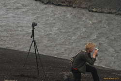
As the evening wears on, we start to play with camera tricks, and then the sky gives us some Aurora to enjoy as well, even though the northern sky is still blue. A great evening topping off a great day.
[1] When we arrived, there as another couple here, with a table and chairs set up, but no tent. We'd been passing each other for the last 45minutes or so, driving north from Hvannalindir, so we were a bit dismayed to find that we had both chosen the same place. But, they left without setting up camp for the night! yay!
